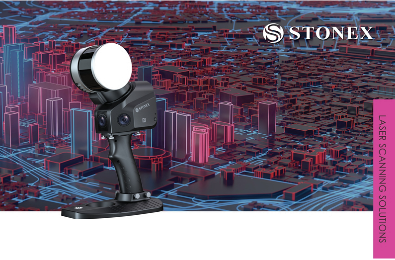
Stonex X120Go SLAM LiDAR
SLAM stands for Simultaneous Localisation and Mapping. The X120GO is a LiDAR-based SLAM system that uses a laser sensor to generate a 3D map of its environment. LiDAR (Light Detection and Ranging) measures the distance to an object (for example, a wall or pole) by a pulse from its laser scanner. It uses an advanced onboard processor to keep track of its location whilst the scanner moves through the area.
An operator using the X120GO can quickly build up a 3D model of a complex area in minutes from turning on. The field acquisition takes as long as it would take to walk in and around the project area. It makes an ideal tool for mapping a cave for Archaeology or a tunnel in underground mining. Other applications might be to quickly survey an accident scene or for an As Built survey at a construction site. The 3D data can be used to quickly calculate volumes at a busy mine site or to create a contour map of an area.
STONEX SLAM technology delivers more range and more points per second than its competitors. It’s best in class on board processing algorithms reach unmatched speed of capture and reliability even in demanding environments. No more multiple scan stations, just move around the scene to collect the entire 3D point cloud, without time-consuming cloud to cloud alignment. See in real time your scanning progress using the included Android App from Stonex. When you are happy that all areas have been covered, simply download the data on to your computer to post process.
Reference points (targets) can be placed prior to scanning the project area. Control points can also be collected whilst capturing data for the point cloud. The processing software can then use these points to georeference the point cloud for the final output.
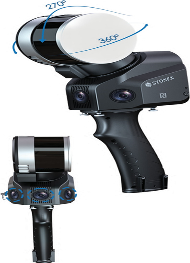
The X120GO has three (3) integrated cameras, that cover the wide field of view of the laser scanner, to obtain coloured point cloud imagery and panoramic images. Click for Video
Vehicle mount setup Click for Video
Bundled Software.
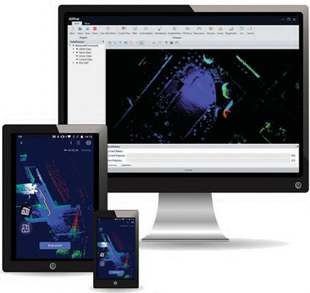
The GO App is the mobile application for X120GO to use when scanning points. It also manages projects, real time point cloud display, image preview and firmware upgrades. This App runs on the Android operating system and suited to the UniStrong / Stonex range of tablets that we sell.
GOpost is used to post-process the data collected by the X120GO to produce high-precision point clouds, local panoramas, optimize point cloud results, and the ability to browse point cloud. This software runs on Windows 10 or higher.
Stonex and 3rd party software
Stonex Cube-3d is Photogrammetric software for post processing LiDAR and photo images to create maps and volumes. It can transform image data into highly accurate digital maps and 3D models with extreme precision. It can import Stonex’s Cube-a surveys and the scanned imagery from GOpost as well as being fully compatible with any third-party 3D models.
PointCab Thanks to the collaboration between Stonex and PointCab, you can manage your point clouds with it. PointCab Origins is your Swiss army knife when it comes to the evaluation of point cloud data – working with all laser scanners and compatible with all CAD and BIM systems.
Stonex Reconstructor software allows you to manage and align point clouds acquired through laser scanners or from photogrammetry. It has expandable functionality with add-on modules.
| Laser scan Performance | System Specification | ||
| Maximum range | 120 metres | Memory | 64Gb (expandable) |
| Minimum range | 0.5 metres | Operating system | Android 8 or above |
| Relative Accuracy | up to 6mm in controlled enviro. | Communication | Wi-Fi and NFC |
| Vertical Resolution | 16 channels | ||
| No. of points per second | 320,000 points | Power Specification | |
| Field of View | 360° horizontal x 270° vertical | Power Consumption | 25 Watts |
| Laser Class | Class 1. | Operating Time | 2.5 hours |
| Echo Strength | 8 bits | Capacity | 13,400 milli Amp hours |
| Camera Performance | Physical Specs. | ||
| Cameras | 3 x 5 Mega pixels | Weight | 1.75 kg |
| Cameras FOV | 200° horizontal x 100° vertical | Size | 372mm x 163mm x 106mm |
| Image | Semi-spherical, RGB | Operating Temp. | -10°C to 45°C |
| RGB Point Cloud | Colour rendering | Operating Humidity | < 85% Relative Humidity |
| Waterproof / Dustproof | IP54 rating |


X120Go standard package is $32,000.00 exGST includes X120Go Accessories click for information | amount exGST |
| X120GO Vehicle mount | $5,750.00 |
| X120GO Vehicle mount + RTK GNSS bundle setup video | $9,500.00 |
| X120Go Rigid Backpack | $2,200.00 |
| X120Go Rigid Backpack + RTK GNSS Bundle | $6,000.00 |
| X120Go RTK Module | $4,000.00 |
| X120Go Shoulder mount | $2,300.00 |
| Tablet holder | $500.00 |
| Base plate for the X120Go – replacement | $100.00 |
| Handle for the X120Go – replacement | $150.00 |
| GOpost software dongle key – replacement | $380.00 |