Stonex XVS vSLAM 3D Scanner
The Stonex XVS vSLAM 3D Scanner is a compact and powerful handheld mapping device that combines advanced visual SLAM algorithms, high-resolution imaging, and inertial measurement technology to deliver fast and accurate 3D reconstructions.
Designed for dynamic environments, the XVS allows users to walk freely through spaces while capturing spatial data in real time. Its intuitive interface displays the user’s trajectory live on a tablet, guiding movement to ensure optimal image overlap and complete scene coverage. The integrated IMU enhances image continuity and stability, even in areas with weak structural textures.
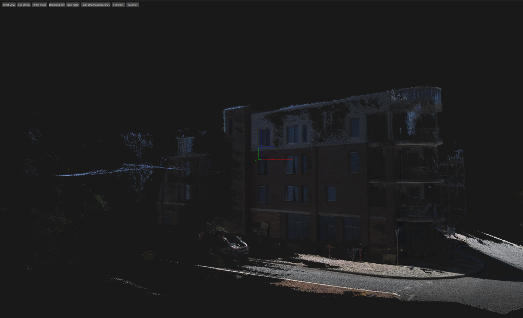
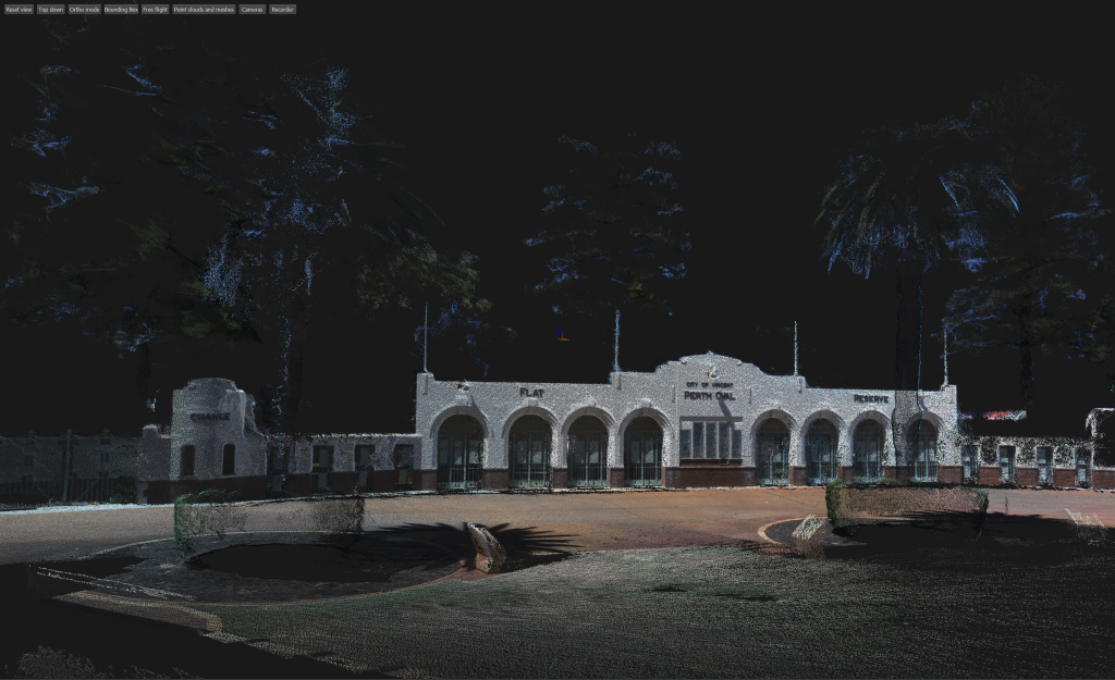
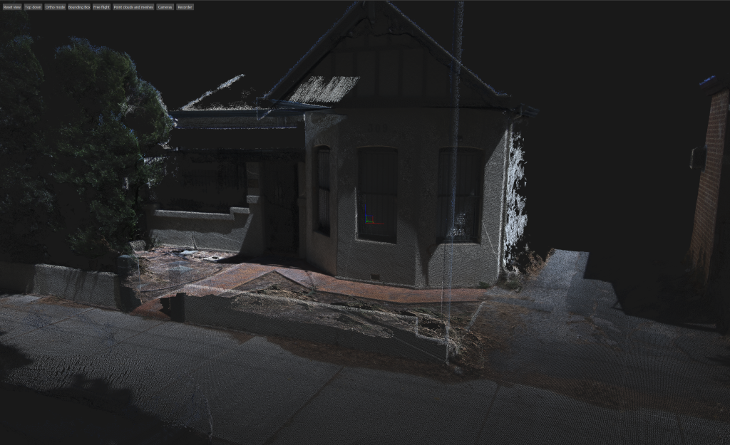
What sets the XVS apart is its photogrammetry-driven workflow. The system captures high-resolution images that are automatically processed into dense, georeferenced point clouds using the XVS Cloud platform. This cloud-based engine performs image alignment, camera pose estimation, and 3D reconstruction with minimal user input. The result is a detailed and accurate 3D model that can be exported for use in CAD, BIM, or GIS applications.
The photogrammetric process also supports texture mapping and mesh generation, making it ideal for architectural documentation, cultural heritage preservation, and infrastructure inspection. With no need for external targets or complex setups, the XVS streamlines the entire survey process—from field capture to final model—delivering professional-grade results with speed and simplicity.
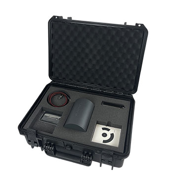
The XVS kit is $10,000 exGST and includes
Hard Shell carry case
Thunderbolt USB C cable
Handle
multiple Targets

The Stonex XVS is equipped with a high-resolution camera system that captures detailed imagery essential for generating accurate, photogrammetry-based 3D models. YouTube video is here
Visit our office for a demonstration

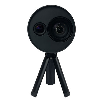
Camera System
Equipped with a high-resolution camera, the XVS captures detailed images that serve as the foundation for photogrammetric reconstruction. These visuals are essential for generating textured, georeferenced 3D models with exceptional clarity and realism.
• XVS App
This mobile application features a simple, intuitive interface that guides users through critical steps during data collection. It alerts operators if objects are not captured correctly and allows full customization of camera parameters to adapt to varying environments. The app is compatible with Android and iOS devices, with the Microsoft® Surface PRO tablet recommended for optimal performance (not included in the bundle).
• XVS cloud
After field capture, data can be uploaded to XVS cloud for advanced processing. The cloud service automatically converts images into point clouds or mesh formats, which can be used in Cube-3D or other third-party software platforms. This streamlined workflow eliminates the need for manual alignment and accelerates project delivery.
Key Features and Benefits
• Accurate
The smart algorithm selects the best images to enhance model precision. When scanning close to objects (around 1 meter) and completing a loop closure, the system achieves an accuracy of 2–3 mm.
• Rapid and Efficient
Users can simply move around the scene to collect a complete 3D point cloud, eliminating the need for multiple scan stations and reducing post-processing workload.
• Easy to Use
Designed for accessibility, the XVS can be operated by multiple team members without prior experience in 3D scanning. The guided field application ensures smooth data collection.
• Versatile Applications
The XVS is suitable for a wide range of scenarios, including infrastructure documentation, accident reconstruction, utility mapping, building facades, and archaeological or geological surveys. Its geometric accuracy and color realism make it a valuable tool across industries.
• HD Textures
Based on high-resolution imagery, the system reconstructs material textures with exceptional clarity and detail.
• Advanced Data Processing
The cloud-based engine handles image alignment, camera pose estimation, and 3D reconstruction automatically, delivering professional-grade results with minimal user input.
The Stonex XVS vSLAM 3D Scanner offers a powerful combination of mobility, precision, and ease of use—making it an ideal solution for professionals seeking efficient and reliable 3D capture on every use.
Stonex XVS Technical Specifications
| Category | Feature | Specification | Notes |
|---|---|---|---|
| Performance | Minimum Range | 0.4 m | |
| Maximum Range | 40 m | ||
| Trajectory Accuracy | 4 mm | In post-processing | |
| Relative Accuracy @1m | 3 mm | ||
| Relative Accuracy @20m | 2 cm | ||
| Imaging | VSLAM Camera Resolution | 640 × 480 px | |
| VSLAM Camera FOV | 65° | ||
| VSLAM Camera Frame Rate | 25 fps | ||
| RGB Camera Resolution | 2448 × 2048 px | ||
| RGB Camera FOV | 89° | ||
| RGB Camera Frame Rate | 10 fps | ||
| RGB Camera Shutter Type | Global | ||
| System | IMU | Gyroscope, Magnetometer, Accelerometer | 3 of each |
| Communication & Power | USB-C 3.0 | ||
| Electrical Spec | Supply Voltage | 5V | Via USB |
| Power Consumption | Max 4W | ||
| Physical Spec | Device Weight | 740 g | |
| Total Case Weight | 5 kg | ||
| Dimensions | 151 mm × 120 mm | Length × Diameter | |
| Operating Temperature | 0°C to +40°C | 32°F to 104°F |
Understanding the Difference: Stonex XVS vSLAM Compared to LiDAR SLAM
The Stonex XVS uses Visual SLAM , which relies on high‑resolution cameras to track movement and reconstruct 3D geometry from visual features. This makes it lightweight, highly portable, and ideal for scanning monuments, artifacts, and small‑ to medium‑scale environments where texture and visual detail are abundant. Unlike LiDAR‑based SLAM systems which measure millions of laser points per second to capture precise geometry—VSLAM does not require a laser sensor and instead builds its model from imagery alone. As a result, the XVS offers a cost‑effective, easy‑to‑use solution with no need for high‑end computers or graphics cards, thanks to its cloud‑based processing workflow. While LiDAR SLAM excels in accuracy, range, and performance in low‑texture or outdoor environments, the XVS provides a simple, fast, and accessible 3D capture method for cultural heritage, education, and general documentation tasks.
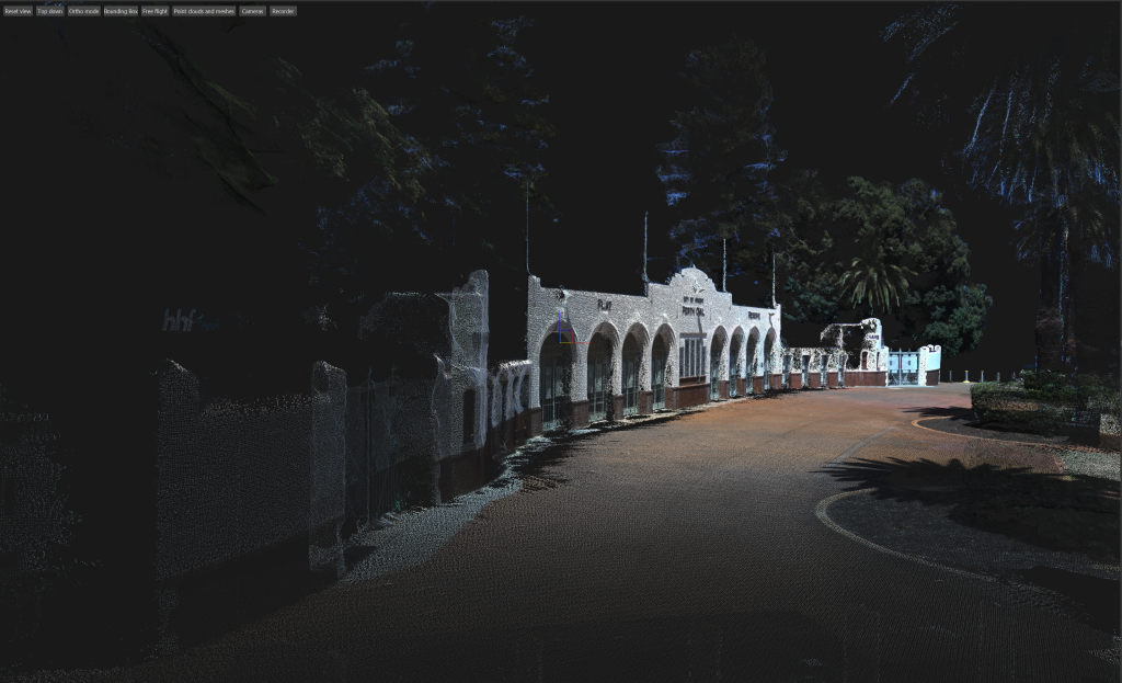
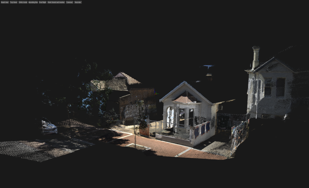
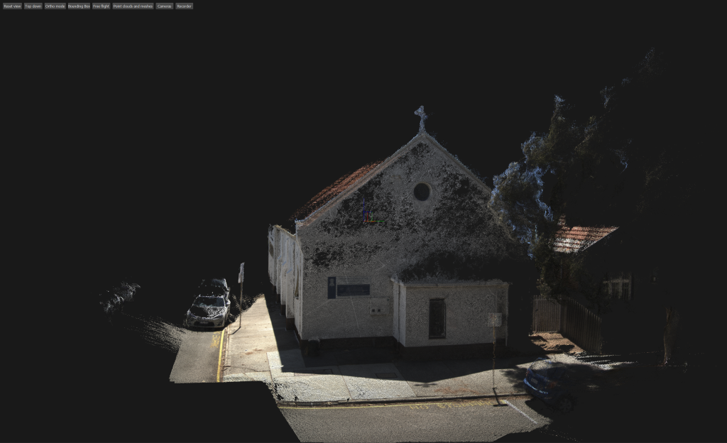
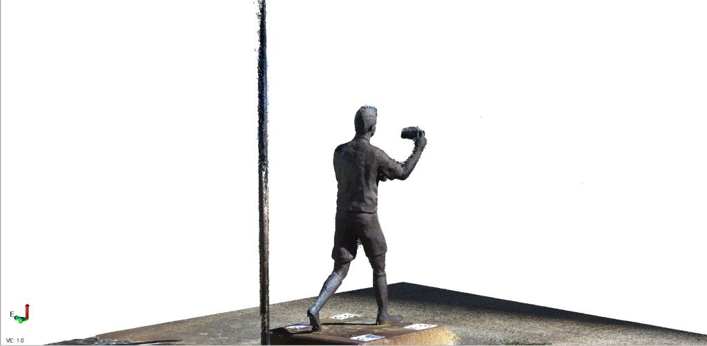
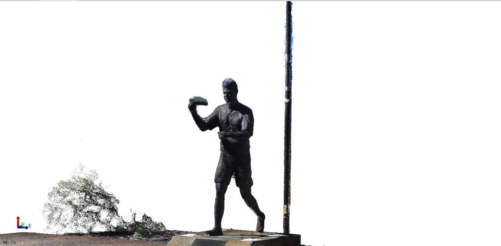
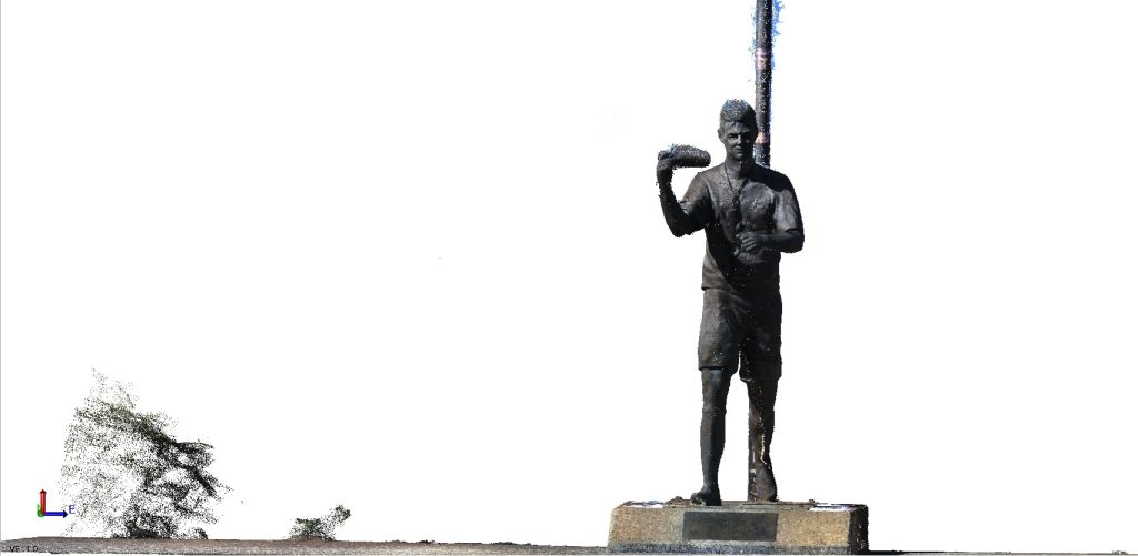
Stonex XVS –vSLAM Scanning for Monuments & Artifacts
The Stonex XVS VSLAM system is an ideal solution for scanning monuments, cultural heritage sites, and delicate artifacts. Using advanced Visual SLAM technology, the XVS captures detailed point clouds with rich feature extraction simply by walking around the object—no tripod setups, no complex workflows.
Because the processing is handled through the Stonex cloud‑based application, there is no need for a high‑end computer or graphics card. Users can upload their scan data directly from the field, and the cloud engine automatically generates clean, accurate point clouds ready for measurement, inspection, or 3D reconstruction.
This makes the Stonex XVS a powerful, lightweight, and accessible tool for museums, archaeologists, surveyors, and digital‑heritage professionals who need fast, reliable 3D results without advanced processing skills.